Anthony on , , 16 Aug 2008 04:46 pm

I was chatting with my mother last week, and she had mentioned how she and Dad were out caching a few weeks ago and managed to scratch the BBT up a little bit.  That reminded me of the 3 province geocaching trip that Gwen, Aidan, and I took while we were back east in the spring.  Not because we scratched the truck up, but because we certainly took it places of the like it hadn’t been too much.

According to my geocaching logs, it was May 30th, 2008.  It was a nice sunny day and our plan was to drive to PEI via the Confederation Bridge.  We were going to cache along the way, making sure that we got caches in each province.  We made the decision that we weren’t going to try for any caches until we got north of Truro, and so the first one that Gwen picked out (we had a Pocket Query that found all the caches along our route within 100m of the highway) was GC16EQC Blueberry Fields.  The cache description, though brief, sounded alright and so we went for it.

The directions on the cache page are simply:

Do not stop or park on highway 104 to access this cache. You can get to this cache by exiting at exits 8 or 10, depending on the direction you are coming from. This way you will see the beautiful scenery and also avoid the toll on the Highway.

As we were heading north, we took Exit 10.  This was the Bass River Road, leading into Londonderry.  A typical Nova Scotia rural road.  The GPS then routed us north again … and then most unexpectantly the pavement disappeared.

In fact, we were driving on a dirt road for the next 25 km or so.  As dirt roads go, it was in very good shape, probably having been repaired after the winter.  In fact, it was in better shape than some of the paved roads up around Amherst (Hi Buffy!  She’s the engineer at NSDOT responsible for roads in Cumberland County.  It was a tough winter apparently).

I’ve got a fair bit of experience driving dirt roads now (Gwen and I drove up to Iqaluit — and back —  on the Dempster Highway in 2004 and it’s 99% unpaved) so it was a fun drive.  Well, other than the fact we really didn’t know where we were going.  OK, so we had the GPS with us, but still.

Anyway, after some time of driving along the dirt road, we came to a nice overpass crossing the TransCanada.  The bridge was paved, but the approaches weren’t.  Weird.  I guess that’s what happens when you have a private company build and operate the Cobequid Bypass.

A short time after that, we arrived at the “Pioneer Graveyard” that served as parking for the cache.


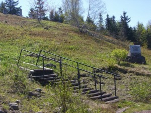
Westchester Mountain Pioneer Cemetery

Westchester Mountain Pioneer Cemetery

Westchester Mountain Pioneer Graves

Westchester Mountain Pioneer Graves

We hoofed it up into the graveyard and happened upon a snowmobile trail.  The cache itself seemed to be directly ahead of us, but the trail ran perpendicular to that.  After a short walk in the wrong direction, we turned around and followed the trail to the cache.

Which was up quite a hill.


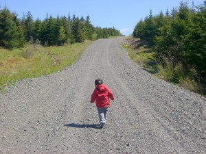
Snowmobile Trails Leading to Blueberry Fields

Snowmobile Trails Leading to Blueberry Fields


Within spitting distance of the TCH.

Aidan Retrieves the Blueberry Fields Cache

Aidan Retrieves the Blueberry Fields Cache


Having cleverly located and signed the cache, we went back to the truck and tried to figure out how to get back to the highway.  The easiest thing seemed to be to go to the overpass and see if there was any way to get on the highway from there.  After rolling back and forth across the bridge a few times, it was pretty clear that we weren’t going to be able to do that — at least not with the truck we had.  So, the only options were to retrace our path or to continue along the same dirt road (which was the route the GPS suggested).

Onward!

In actuality, the trip out was much shorter and we soon regained pavement.  After that, it was a short drive to Exit 8 to get back on the highway and continue to New Brunswick.

All totalled, we probably spent in the neighbourhood of 3 hours getting to and finding that one cache.  Not a great start to our tri-province caching adventure in terms of efficiency, but we had fun finding it.  You can read my log here.  I’ve provided a handy map below too, detailing the excursion.

View Larger Map

Anthony on , , , , , 04 Aug 2008 08:34 pm

Hmmm, a dramatic title for a post with no substance!  Just to bring the Kayla story-arc to a close:

  • After hiking on Monday, a cliff collapsed on the Sea-To-Sky highway (on the Tuesday) closing it for 5 days.
  • It rained for a good part of the rest of the week.  Gwen and Kayla did lots of shopping (Gastown, Pacific Centre, etc).
  • Friday Kayla took us out to dinner, back to Shabusen.  It was going rather well until Aidan … um, soiled himself.  And the booth bench.  And his shoes.  Ugh.  I got him all cleaned up and then Aidan and I drove home (and I tossed him in the shower) while Kayla and Gwen finished up and then walked home.
  • Saturday we went to Lynn Canyon in the morning, and the Gwen and Kayla went to Playland that afternoon.


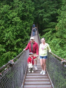
The Lynn Canyon Suspension Bridge

The Lynn Canyon Suspension Bridge

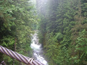
The view north from the Lynn Canyon Suspension Bridge

The view north from the Lynn Canyon Suspension Bridge

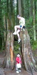
Kayla and Aidan in the Lynn Creek Park

Kayla and Aidan in the Lynn Creek Park

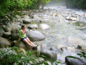
Kayla beside Lynn Creek

Kayla beside Lynn Creek

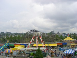
Playland at PNE

Playland at PNE

  • To end out the day, Carla and Tomer (new engaged!) came over and we had a games night, mildly interrupted by the Festival of Light finale fireworks.
  • And on Sunday, we put Kayla on the plane to head back to Nova Scotia. According to her mother, she arrived safe and sound … but overtired and excited.
Anthony on , , , , , , 29 Jul 2008 09:29 pm

This weekend past, we took Kayla to stay with a friend she had in Halifax who now lives in Metchosin.  This involved getting everyone up and going early Saturday morning to head to Tsawwassen to catch the 8 am ferry.  Early was leaving the house at 6:30 am.

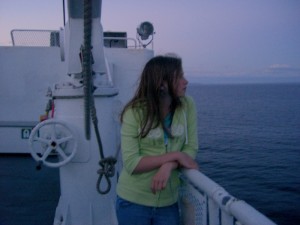
It was a nice trip across to the Island, lots of sunshine, calm waters, and not too chilly.

After a stop in Sidney to grab some breakfast from Smitty’s, we headed to Metchosin.  Metchosin is south-west of Victoria.  Getting to Kayla’s friend’s house was interesting … we had the wrong street address and the GPS took us to a place that didn’t make a lot of sense.  With a little bit of a description from Kayla and the belief that we couldn’t be that far out, we eventually found the base (CFAD Rocky Point) and appropriate PMQ where her friend is living. Good thing because it turned out that none of the 3 cell phones we had with us were getting signals that far out.

We dropped Kayla off and headed over to visit with my cousins Mike and Gert and their kids.  It’s been quite some time since I’ve seen Mike’s kids, and wow, they’ve grown.  We visited a short while and then the 3 of us headed out with Mike to do some geocaching on the grounds of Royal Roads University.  Mike has one of those high-sensitivity GPSr’s (a Garmin Rhino) and was getting much better reception than we were.  Even still, he was smoking hot, nabbing all the 5 or 6 caches we got that afternoon (well, actually Gert got one too).  Gert came and met us half way there.  Aidan, unsurprisingly, took quite a shine to Gert.

We headed back and had supper with Mike and Gert and their daughter Marie.  After a great supper, we drove up the Malahat to Nanaimo to stay the night before heading up to Campbell River the next day.

It was the first time we’ve stayed with Aidan in a hotel room.  It was rough.  He just wouldn’t go to sleep, insisting on talking to us and singing.  When the fireworks started going off (no, seriously, fireworks) at 10 pm, fortunately he was asleep.

We found out that night that our Sunday plans had changed and instead of going up to Campbell River, we were going to meet my Aunt Jean in Nanaimo.  That meant we had some time to kill that morning, so we decided to do some geocaching.  Well, none of us slept particularly well, so you can imagine the moods we were all in.  Cranky 3 yr old, cranky 34 yr old and cranky and pregnant 30-something.  Adding to the geocaching difficulty were the Nanaimo bath tub races.  Muggles everywhere!

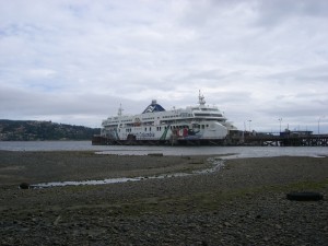
We only managed to grab two caches, one  of them down near the berth of one of the new “Super-C” class ferries.

After a bit of communication SNAFU, we found Aunt Jean on the edge of Nanaimo.  Yes, found.  The GPS came in pretty handy.

After lunch with Aunt Jean (note: Aidan has been saying “See you later, Sunshine” since then) it was a leisurely meander back down towards Victoria.  We stopped in Cowichan Bay and grabbed some artisan cheese (from Hillary’s) and bread from the wonderful “slow food” stroll along the shoreline there.  After Cowichan Bay, we headed into the Cowichan Valley and stopped by the Merridale Cidery and I picked up some hard apple cider.  I had been to both places while participating in the Grape Escape 3 years ago.

After that, it was pretty routine.  We headed back to Metchosin (and took some pictures along the way) picked up Kayla (Aidan really missed her) and headed back up the highway to the ferry.

Good thing we had reservations … we would have had a one or two sailing wait otherwise.  We were a little bit late leaving and didn’t pull into Tsawwassen until 10 pm.

Whew, what a long weekend.  Then the hike yesterday.  Now, it’s 9 pm and I’m ready for bed.

Anthony on , , , , , , , , 22 Jul 2008 09:14 pm

On Sunday, we woke the live-in teenager up early and headed south to Seattle.

Happily enough, we were out of the house on time, and the drive to the Peace Arch was uneventful.  The wait at the border was about a half hour, but getting through was one of the easiest crossings I’ve ever had.  I think I said that last time I crossed the border too.  There must be something about my demographic that is appealing to the border guards.  We had a letter of permission for Kayla, but it proved unnecessary and that was a good thing too, because the letter indicated that we were the aunt/uncle of Kayla but I told the border guard Kayla was Gwen’s cousin (which is correct).  It might have been awkward if he asked to see the letter.

We raced down to the Seattle Premium Outlets in Tulalip where Gwen and Kayla shopped while I entertained Aidan with the motorized ride-on toys (which he’s happy to play on without putting any money in) and pushed him around in a car-shaped ‘stroller’.  We were there for about 3 hours, and between the two of them they only bought $180 of clothing.

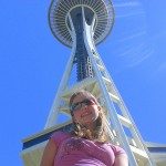
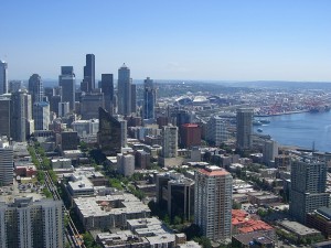
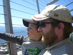
From there we drove down to Seattle proper.  The plan was to go to the Space Needle and then hit the Pacific Science Center and follow it up with a visit to the Pike Place Market.  Well, when we got to Seattle Center (eventually … the traffic on I-5 was heavy and slow; it took us an hour) wow was it crowded.  We had no idea it was such a popular summertime place.  We went to the Space Needle with the logic that we had to do it at least once.  It was a long wait, expensive, and somewhat underwhelming.  But, we’ve been up the Space Needle.  It was the only place we took pictures.

After the Space Needle, we were all rather tired and it was around 4pm, so we gave the Pacific Science Center a miss.  We headed down to the Pike Place Market and gave it a quick run-through.

Heading north again, we had supper in what has become our traditional suppertime venue in coming back from Seattle: The Flying Pig in Everett.

After a more eventful supper than I’d have liked (Aidan knocked over a full glass of root beer on the table) we headed up I-5 again.  About 30 miles south of the border, we tuned into News 1130 (traffic on the 1’s!) and heard that there was a 1:30 wait at the Peace Arch (that’s 90 minutes!) and a two hour wait at the Truck Crossing.  And no wait at the other border crossings.  We immediately took the next exit off the highway, pulled out the Eee and fired up the GPS and Streets and Trips.  It didn’t take too long for us to get a route to the Aldergrove border crossing (which is the next one east from the Truck Crossing) and then we were off on a back-road-of-Washington tour.

And the Aldergrove border crossing?  *AWESOME*  A total of *5* cars ahead of us.  And once again, no interference from Canada Customs.  Even having to drive back up the Valley meant that we got home at least an hour before we would have had we come up the Pacific Highway.

How tired were we on Monday, though?

« Previous PageNext Page »