 I was chatting with my mother last week, and she had mentioned how she and Dad were out caching a few weeks ago and managed to scratch the BBT up a little bit. Â That reminded me of the 3 province geocaching trip that Gwen, Aidan, and I took while we were back east in the spring. Â Not because we scratched the truck up, but because we certainly took it places of the like it hadn’t been too much.
According to my geocaching logs, it was May 30th, 2008. Â It was a nice sunny day and our plan was to drive to PEI via the Confederation Bridge. Â We were going to cache along the way, making sure that we got caches in each province. Â We made the decision that we weren’t going to try for any caches until we got north of Truro, and so the first one that Gwen picked out (we had a Pocket Query that found all the caches along our route within 100m of the highway) was GC16EQC Blueberry Fields. Â The cache description, though brief, sounded alright and so we went for it.
The directions on the cache page are simply:
Do not stop or park on highway 104 to access this cache. You can get to this cache by exiting at exits 8 or 10, depending on the direction you are coming from. This way you will see the beautiful scenery and also avoid the toll on the Highway.
As we were heading north, we took Exit 10. Â This was the Bass River Road, leading into Londonderry. Â A typical Nova Scotia rural road. Â The GPS then routed us north again … and then most unexpectantly the pavement disappeared.
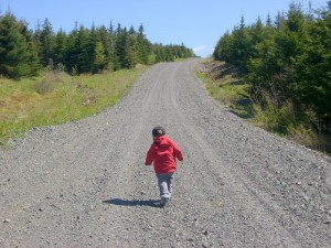
In fact, we were driving on a dirt road for the next 25 km or so. Â As dirt roads go, it was in very good shape, probably having been repaired after the winter. Â In fact, it was in better shape than some of the paved roads up around Amherst (Hi Buffy! Â She’s the engineer at NSDOT responsible for roads in Cumberland County. Â It was a tough winter apparently).
I’ve got a fair bit of experience driving dirt roads now (Gwen and I drove up to Iqaluit — and back —  on the Dempster Highway in 2004 and it’s 99% unpaved) so it was a fun drive.  Well, other than the fact we really didn’t know where we were going.  OK, so we had the GPS with us, but still.
Anyway, after some time of driving along the dirt road, we came to a nice overpass crossing the TransCanada. Â The bridge was paved, but the approaches weren’t. Â Weird. Â I guess that’s what happens when you have a private company build and operate the Cobequid Bypass.
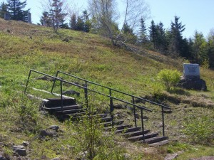
A short time after that, we arrived at the “Pioneer Graveyard” that served as parking for the cache.
We hoofed it up into the graveyard and happened upon a snowmobile trail. Â The cache itself seemed to be directly ahead of us, but the trail ran perpendicular to that. Â After a short walk in the wrong direction, we turned around and followed the trail to the cache.
Which was up quite a hill.
Within spitting distance of the TCH.
Â
Having cleverly located and signed the cache, we went back to the truck and tried to figure out how to get back to the highway. Â The easiest thing seemed to be to go to the overpass and see if there was any way to get on the highway from there. Â After rolling back and forth across the bridge a few times, it was pretty clear that we weren’t going to be able to do that — at least not with the truck we had. Â So, the only options were to retrace our path or to continue along the same dirt road (which was the route the GPS suggested).
Onward!
In actuality, the trip out was much shorter and we soon regained pavement. Â After that, it was a short drive to Exit 8 to get back on the highway and continue to New Brunswick.
All totalled, we probably spent in the neighbourhood of 3 hours getting to and finding that one cache. Â Not a great start to our tri-province caching adventure in terms of efficiency, but we had fun finding it. Â You can read my log here. Â I’ve provided a handy map below too, detailing the excursion.


