 Today, Aidan, Gwen, Tomer, Carla, and I participated in the Tailspin GeoRally.
This was a geocaching event that featured 20 teams of cachers trying to find a series of caches placed especially for the event. The rally started in Confederation Park in North Burnaby. Cars left the staging area every five minutes from 8:45am onwards, and our start time was 9:25am (Team 9). At the start, you were given the guidelines for the event and the coordinates for the first cache. Caching teams alternated between starting at waypoint number 1 and waypoint number 6. Teams that were on the first track had green passports and teams on the second track had yellow passports. At each waypoint, teams found the coordinates to the next waypoint (perhaps after solving a puzzle) as well as a stamp for their passport. You had to collect all the stamps or incur a 45 minute penalty. Additionally we were given a baggie with hints for each waypoint, each stapled shut. If teams opened any hint, they incurred a 15 minute penalty for each hint opened. The goal was to cross the finish line with the shortest time. We weren’t given any details about the caches, but we were told that one of the caches was ‘manned’. We joked a little about that (a man cache? huh?) and it came out that the cache was actually ‘boy-ed’ since the children of one of the organizers would be running the waypoint.
Waypoint 1
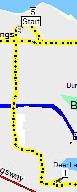 So, after receiving our instructions, we were off to Waypoint 1 (9:25 am). Waypoint 1 was about 8 km, generally south. We headed out, debating on how long to look for caches before cracking open the hint. We knew that the next team heading to the cache (Team 11) was going to be leaving 10 minutes after us, so we had about 10 minutes to search before the next team showed up. We didn’t really want to bunch up, since other teams would share the find and potentially give the team behind us an advantage. However, we really didn’t want to use the clues either. So, we decided that we’d try for 15 minutes for the first cache, and then use the hint, and re-evaluate after that cache.
When we arrived at the cache (9:38 am) we saw another vehicle parked at the trailhead, but didn’t know if it was another team or not. We all beat it down the trail (about 250 m) and discovered that Team 7 was still there (they were the team that left at 9:15 am, the team on our track who had left before us). We all started looking, and soon one of Team 7 discovered the cache. It was an ammo can with a tape inside that contained the coordinates … but it was only readable once you had wrapped it around the pole that was near the cache. We stamped our passport and double-timed it back up the trail to the car. By that time, we passed Team 11 coming down the trail. We were the first car to leave the cache!
Waypoint 2
 The trip from waypoint 1 from waypoint 2 was relatively uneventful, other than trying to follow the GPS around Deer Lake Park (it thinks there are roads where there aren’t). We’d been in the area before so we knew that. Still we got a bit detoured.
Unfortunately, the cache location was a bit ambiguous. It was on the side of a stream … but it wasn’t clear which side. I picked one side, and wouldn’t know it, it was the wrong side. We arrived around 10:04 am, searched for about 5 minutes and then hightailed it over to the other side of the stream. There was a huge wall of blackberry bushes in the way at the wrong location, and evidence of previous teams trying that approach too. At the correct approach, it was obvious that it was right … what with there being a marked trail. Carla and Tomer jumped out of the car while the rest of us hunted up some parking. The closest legal parking was still kind of sketchy, so Gwen and Aidan stayed in the truck while I ran (yes! ran!) down the trail to catch up with Carla and Tomer. On the way, I ran into Team 7 again, heading to the cache from an entirely different direction.
And we searched. And searched. Eventually Team 11 caught up to us and we all searched. And searched. Up on the trail. Down by the stream. All over.
Then, Team 11 managed to grab the cache, and replace it completely without any of the rest of us knowing. I have no idea how, but they did. We saw, at least, where they came out of the brush so of course we all rushed and looked in that general area, but couldn’t come up with the cache. After some discussion with the rest of the team I called Gwen to open the hint. She read it to me over the phone and I headed to where I knew the cache was. And, just as I arrived to where I thought it was, the other team found it. Arrrgh! This one was a peanut butter jar, fitted into a log that had been sliced in half and hollowed out.
We got the coords, got our stamp, and hoofed it back to the car. Total time spent there was about 26 minutes (it seemed longer) and we pulled out around 10:36 am. The next waypoint was 5 km away.
Waypoint 3
 This was a quick waypoint for us. We drove up to the parking area, and Gwen and Aidan stopped by the bathroom facilities while Tomer, Carla, and I hoofed down the trail a bit. It didn’t take too long, and wouldn’t you know, we saw Team 11 there already. They had just found the cache, but on opening it, we discovered that in order to retrieve the next coordinates we had to put a bunch of puzzle pieces together. They seemed a little reluctant to share the puzzle, but quickly overcame that. Gwen and Aidan joined us and soon enough we had the coordinates to the next waypoint. As we were leaving, Team 7 pulled up. Back to the car and we’re off again, total time spent was about 10 minutes. This waypoint apparently gave the first few teams a hard time, but I’m not too sure why. Of course, we didn’t actually look for the cache, so that might have helped! :)
Waypoint 4
 Waypoint 4 was another 9.6 km away, in a bit of a loop around Burnaby Mountain. We arrived to an empty parking area, just south of the train tracks off of Burrard Inlet at about 11:05 am. The waypoint was a short hike down a closed road, across the railroad tracks and then to a beach! On the beach, Irene (from 911Turbos) was there with some of her children. The waypoint was out at a buoy floating in Burrard Inlet. To reach the buoy, members of the team had to paddle a canoe out, retrieve the cache and coordinates, and then bring them back to the beach where (if the coordinates were correct) you got your stamp. Carla and Tomer strapped on the life-jackets and easily paddled out to the buoy. I think they had quite a bit of fun doing it, even if the return trip from the buoy was … fun to watch. As you may have guessed, this was the “boy-ed” waypoint; I don’t think the pun was intended when we got our instructions, but maybe it was! We had a good laugh about it as we were driving away, but as we were leaving the waypoint we encountered Team 7 arriving, followed shortly by Team 11. Total time at the waypoint: 13 minutes according to the GPS.
Waypoint 5
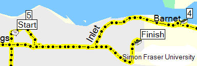
This waypoint was back in Confederation Park. We arrived again to an empty parking area (around 7.5 km away, arrived at 11:27 am) and all of us went a short way down the trail. There was an obvious cache-hiding tree not far down the trail and after noticing a rope, I climbed up the tree and pulled an ammo can up from the interior of the tree. We made short work of the cache, and got it back and hidden when we saw … Team 11 and Team 7. I don’t know how they made it through the canoe challenge so quickly, and how they arrived together, but there they were! Hopefully it took them a bit longer to find the cache than it did for us. Total time at the cache was a little under 7 minutes.
Waypoint 6
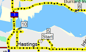 Waypoint 6 was pretty close … about 3 km as the crow flies. Driving, it took us over 15 minutes and over 10 km. The cache was across the Ironworkers’ Memorial Bridge in Deep Cove. As a matter of fact, we had all been to this *exact* location last weekend looking for a cache (the one we DNF’d). Tomer, Carla, and Gwen went down to ground zero (down some stairs to the shore of Burrard Inlet) while I wrangled the boy. Aidan and I didn’t even make it down to the beach when Tomer, Carla, and Gwen sprinted by us in the opposite direction. Yes, Gwen was running too. She was thrilled that she had found the cache (another ammo can) just like >that<. Team 11 pulled in behind us just as we were leaving. Total time at the cache: just over 6 minutes.
Waypoint 7
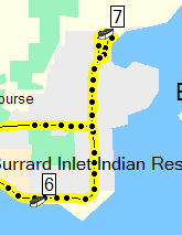 Waypoint 7 was also in Deep Cove. In fact, it was near one of the *other* ones we did last weekend. This one seemed to be off of Panorama Drive, but it was up in some trees, and there didn’t seem to be an entrance between the many houses. We decided to approach it from the top-side. Again Gwen, Carla, and Tomer headed off to the cache while I parked the car and wrangled the boy. This one was a bit of a hike, (250 m or so) and while Aidan and I were still hiking to the cache, I heard a call out telling us to turn around and go back. Apparently Carla ran into Team 11 (slowly becoming our Nemesis!) *already* at the cache. They had found a trailhead down on Panorama Drive. We all assembled back at the car and headed out again!
Waypoint 8
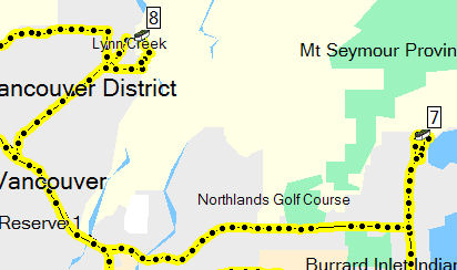 Waypoint 8 was quite a drive away — over 14 km and 21 minutes away. Arrival time was 12:36 am — about 3 hours in. This was another time of trusting the GPS too much. It directed us up beyond the Lynn Canyon Suspension Bridge and when I took a look at it, I saw that it was *on the other side* of the creek. So, we drove down to the parking lot at the suspension bridge. This time, Gwen marshalled Aidan (she had to test her blood sugar and eat something too) while Carla, Tomer, and I jogged down to the waypoint. It was a bit further away (about 500 m), but we got there pretty promptly. And at that cache, we met Team 20. This team started last (at 10:20 am) and were on the other “track” — yellow passports. As such, this was their 3rd cache. They had the cache open, so we jotted down the numbers, got the stamp, and headed back out to the parking lot with them. This time, though, we didn’t see hide nor hair of Team 11 or Team 7, which was both reassuring and puzzling.
Waypoint 9
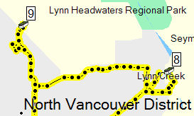 Waypoint 9 was also quite a drive away, about 7.6 km near Mosquito Creek. We arrived near 1 pm. There was a short hike up a closed road to some water tanks. At that point, there was a trail that went left, over a small bridge, and right, up behind the tanks. The cache was clearly on this side of the creek (I’d turned on the topo maps by that point) so Tomer went right. The trail was rooty and steep but not too bad. We quickly came to another split in the trail. Tomer took another right. By this point I was carrying Aidan on my shoulders. We went up a trail for some minutes and then we got a shout from Tomer indicating that the trail wasn’t taking us in the right direction. So, we went back down to the last split and at that point, we met up with Team 20 again.
The trail to the left was steep. According to the GPS, we gained 70 m over 200 m which works out to about a 38% grade. Gwen and Aidan decided the trail was too steep, so they stayed down while the rest of us, and Team 20, went up the painfully steep trail. The trail got us to within about 40 metres of the cache … and more than 20 m vertically (according to the topo). It was quite a cliff, and we were on the top side. We had quite a bit of discussion at this point. Eventually, we “wandered” a bit down the trail and some of us took the “quick” way down towards Mosquito Creek … we picked and slid our way down the slope. Sure enough, down there was another trail, running along the creek. With *boardwalks*. We headed back upstream towards the cache, but the GPS receivers were getting absolutely awful reception. And then we were stymied by a debris dam and a 20 m high canyon. And the GPS’ seemed to indicate that we needed to go further upstream.
By this point Team 20 was pretty skeptical about our ability to find caches! :)Â After talking a bit with Tomer and Carla, we decided to go back up to the dam and search around there to see if it was there … logically, no matter what the GPS was saying, it had to be there.
Soon, we were joined by Team 3.
Yeah, I was as confused as you are. Team 3 started at 8:55 am, 30 minutes earlier than us. I have no idea how they managed to arrive at that cache then, but there they were. We hadn’t seen them at any of the other waypoints. It was a bit weird.
Carla soon happened on the cache, a peanut butter jar that had a whole bunch of locks in it. We had been given a combination with our instructions way back at the beginning, and finding out which lock opened with the combination meant getting a 30 minute bonus. At that point, we needed it!
We quickly found the right lock (out of about 20? 30?) and made our way down the very level, easily accessible trail. Where we met Team 7 coming up the trail.
The whole misadventure at Waypoint 9 cost us 55 minutes. It could have easily been 15 minutes. Talking with some of the other teams afterwards, we weren’t the only ones to miss the correct trail.
Waypoint 10
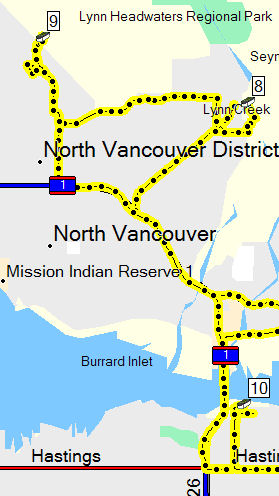 The last waypoint was back in North Burnaby, over 13 km away. We beat our way there, located the trailhead and quickly hustled down the trail. The cache was easily found, a little bit off the trail at the base of a large retaining wall. It was a camo’d ammo can. We pulled the stamp, grabbed a card that told us where the finish line was and raced back to the car.
And met Team 20 coming down the trail.
And Team 3 at the trailhead.
We only spent 10 minutes getting this cache, though, so we knew we were in good shape. All that was left was a dash to the finish line!
Finish
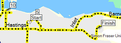 The finish line was on top of Burnaby Mountain, near Horizon’s restaurant: a 9 km/20 min drive. And here, of all places, the coordinates were off. We parked near some other caching vehicles (as evidenced by the various geocaching stickers) and split up looking for the crowd.
We found them at about 2:52 pm.
Our official time (+15 min for the hint, -30 min for the lock, no other penalties — including not wearing life jackets at the canoe cache — were incurred) was recorded as 5h 12min, putting us squarely in 5th place (out of 20!). Our Nemesis (Team 11) recorded 5h 17min! Team 7 rang in at 5h 53min (they must have used some hints too) since Team 3 came in at 5h 35min. Team 20 continued their string of bad luck and arrived with a time of 8h 45min (it didn’t take that long, but they incurred 3x 45 min penalties for skipping the last 3 caches). The fastest team did the whole thing in 3h 55min!
Total distance covered: 108 km (not including travel to the start and from the finish).
There was a great BBQ on the lawn at the park at the finish. We had hot dogs and drinks and door prizes and great stories about the day. Aidan was going around making friends in his own way (the direct approach). And, when prizes were being given out, he amused himself by going up in front of some people (not the whole crowd), spreading his arms wide and saying “Ladies and Gentlemen!” followed shortly by “Run!” at which point he took off across the lawn.
Highly amusing.
I know that we had a great time, and I think Tomer and Carla did too. If you read the logs on the event page, it seems like a universal feeling.
Unfortunately, we were so into it, and juggling so many things that we took almost no pictures! Oh well. There might be some in the event page’s gallery soon.
It was a wonderful day, well organized, and good fun. I hope that it happens again soon.

What a wonderful way to spend a day! Exercise for body and brain and good company.
Nicely done. Great description and documentation of the event. Thanks!
Great blog. We enjoyed the day immensely and also enjoyed reminiscing about it with your excellent synopsis. See you on the trails!
Mr. Huggy of the Huggy Family.
Wow, you must have been keeping notes. Just for the record, team 20 wasn’t following you, we just happened to have the same gps and naturally it took us to the same place. (cough,cough)
olipe
Well put together. You have a natural talent there.
Geodug and I had trouble remembering each cache just hours later. I don’t know how you remembered all that.